Cobb
Fun
Tech
Views
Traffic
Shade
Usage
Biking, Hiking
Dogs Friendly?
Leash Only
Length
1.7 mimiles
ElvElevation
991'
Rating
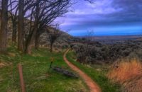
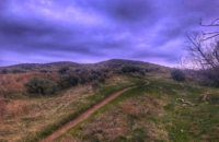
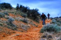
Cobb is the saving grace of the Lucky Peak area trails. It’s the only meaningful singletrack in the area, and makes for a fun, rowdy downhill on a bike. When you get to the rocky section, just point it straight and let it rip. Cobb is too steep and loose for most to climb on a bike, but hikers do ascend it. Cobb is often looped with Highland Valley trail or Homestead trail.
Recent Trail Reports
May 1, 2021 at 12:23 amIt's about 1.5-miles from the upper intersection of Homestead and the dirt road to Cobb; take a right and head downhill on the dirt road, then it climbs and switchbacks up to the marked trailhead for Cobb which should be visible (unless someone has removed the sign...)
April 19, 2021 at 2:38 pmIs Cobb marked? Parked on Council Springs road today and rode Homestead to Lucky Peak. Do you go right at the Intersection of Homestead and Lucky Peak trail after the gate, to get to the Cobb descent?
May 14, 2020 at 10:12 amThere has been a significant increase in foot traffic this year. Historically, it has been used most commonly for the downhill portion of the loop with Homestead. Please pay attention to your surroundings while hiking and please watch your speed while biking.
October 6, 2019 at 9:30 pmIt's rocky and will keep you on the edge of your seat...but its still rideable and fun (downhill of course) even with some loose sections. Makes a good loop in conjunction with Homestead- a must-do classic eastern foothills ride.
April 22, 2019 at 8:29 amThis would be an excellent, downhill-only trail with the potential for better flow and berms. Foot traffic is increasing exponentially on what used to be one of few trails that you could just let it rip and now worry about traffic.
November 24, 2018 at 6:05 pmIn great shape despite (or maybe because of) recent rains. Getting more and more crowded due to the new neighborhoods popping up around it.




Is Cobb marked? Parked on Council Springs road today and rode Homestead to Lucky Peak. Do you go right at the Intersection of Homestead and Lucky Peak trail after the gate, to get to the Cobb descent?
It’s about 1.5-miles from the upper intersection of Homestead and the dirt road to Cobb; take a right and head downhill on the dirt road, then it climbs and switchbacks up to the marked trailhead for Cobb which should be visible (unless someone has removed the sign…)
There has been a significant increase in foot traffic this year. Historically, it has been used most commonly for the downhill portion of the loop with Homestead. Please pay attention to your surroundings while hiking and please watch your speed while biking.
It’s rocky and will keep you on the edge of your seat…but its still rideable and fun (downhill of course) even with some loose sections. Makes a good loop in conjunction with Homestead- a must-do classic eastern foothills ride.
This would be an excellent, downhill-only trail with the potential for better flow and berms. Foot traffic is increasing exponentially on what used to be one of few trails that you could just let it rip and now worry about traffic.
In great shape despite (or maybe because of) recent rains. Getting more and more crowded due to the new neighborhoods popping up around it.